Call Us +1 608 685 3303

110 N Main Street, Alma, WI


Open Hours

June 1 - Oct 31  Thurs-Sun:  11-4

Nov 1 - May 31  Thurs-Sun:  11-4


DISCOVER WHAT ALMA HAS TO OFFER


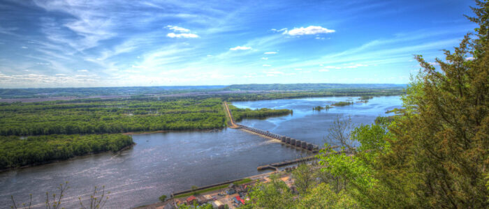
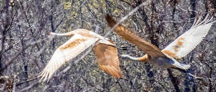
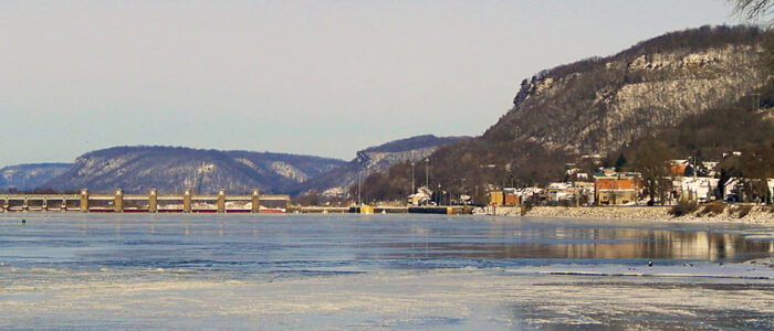
Downtown Alma has about 20 gift shops & galleries in addition to the Wings Over Alma Nature & Art Center. There are restaurants and a restored bakery as well as many lodging options housed in a variety of fascinating 19th-century buildings. Right in the heart of the town is Lock & Dam #4 with observation areas to view lock operations and a large parking lot. Alma has a courtesy dock downtown for boaters, boat ramps at the north and south ends of town, and two full-service marinas with house boat rentals. The Great Alma Fishing Float has been an attraction to fishermen for years, and is particularly popular during the annual walleye run. The Upper Mississippi River Fish & Wildlife Reserve is a major nesting ground for Bald Eagles that can be observed from Alma’s riverbank and from the Wings Over Alma Nature & Art Center viewing deck. See a multitude of Bald Eagles during the Winter months as they fish the open water just below Lock & Dam #4. Alma also boasts of 3 city parks. Buena Vista is 500-feet above the river with some of the most spectacular views found on the Upper Mississippi; drive or hike up to the park. Rieck’s Lake Park offers abundant wildlife viewing and camping, and Mossy Hollow sits on 102 acres with walking and hiking trails.

For more information about city-wide events, shopping, art galleries, lodging and food, please visit the following websites:


Here are some highlights about our town that we don’t want you to miss!


Historic Alma, Wisconsin

Originally known as Twelve Mile Bluff, Alma was named by riverboat pilots for a prominent rock formation located on the bluff which was visible from the mouth of the Chippewa River, twelve miles to the north. Riverboat pilots used the landmark as a guide for navigating their boats and log rafts on the Mississippi River.

In 1848 Victor Probst and John Waecker arrived in the area to cut firewood as fuel for the steamboats that passed their way. These Swiss immigrants were the first settlers, soon to be followed by German, Norwegian and other nationalities immigrating to the United States. In the mid-1850s the settlement below Twelve Mile Bluff was named Alma after the battle on the Alma river in Russia, fought on September 20, 1854, between the English & French on one side and the Russians on the other. Alma officially became a village in 1868.

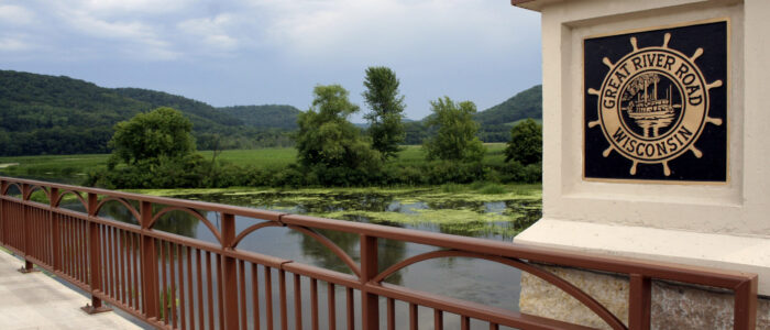
The steep bluffs and the Mississippi River forced the containment of Alma to two blocks wide and seven miles long. From an Indian trail along the river, the settlers built two streets at the base of the bluffs. They were and still are called Main Street and Second Street. A number of short streets connect them but 10 of these “streets” are Alma’s famous “stairstep streets” and only accessible by foot, a unique feature of the City. Main Street is also Wisconsin State Highway 35, a part of the Great River Road and Wisconsin’s first Scenic Biway.

The first industry in Alma was a brewery. This is understandable since the river froze in the winter months isolating settlers, and the Swiss were fond of their special beer. There were also a number of cigar factories. The lumber business prospered at the end of the 19th century when logs were sorted on the backwaters of the Mississippi, largely in an area known as Beef Slough. The Mississippi River has served the area in many ways. In addition to logs, it was moved wheat, a variety of supplies and the daily mail. The arrival of the railroad in 1885 changed things, and later in 1935 the building of Lock & Dam #4 again changed the character of river shipping.

In 1982, thanks to the hard work of the Alma Historical Society, over 200 buildings were included in the designation of the City of Alma as a National Historic District when it was placed on the National Register of Historic Places (NRHP). NRHP is the Nation’s official list of cultural resources worthy of preservation. Authorized under the National Historic Preservation Act of 1966, the National Register is part of a national program to coordinate and support public and private efforts to identify, evaluate, and protect our historic and archeological resources. The National Register is administered by the National Park Service, which is part of the U.S. Department of the Interior.


Lock and Dam #4

To achieve a 9-foot channel in the Upper Mississippi River, the construction of a system of locks and dams was authorized in 1930. Dams are built on rivers to hold water back to form deeper navigation “pools.” Most pools in the United States are maintained at a constant minimum water depth of 9 feet for safe navigation. Dams allow river vessels to use a series of locks to “step” up or down the river from one water level to another. The St. Paul District of the Army Corp of Engineers operates and maintains 13 of the 29 locks and dams on the Mississippi River, beginning at Upper St. Anthony Falls in downtown Minneapolis and ending at Lock & Dam #10 in Guttenberg, Iowa. Lock & Dam #4 is located on Mississippi River mile 752.8 in Alma, Wisconsin. Lock & Dam #4 was constructed and placed in operation in May, 1935. Last major rehabilitation completed from 1988 to 1994. The dam consists of a concrete structure 367 feet long with six roller gates and 22 tainter gates. The earth embankment is 5,400 feet long. The lock is 110 feet wide by 600 feet long. Alma has an observation bridge from which tourists can get a good look at the lock and dam operations. The bridge is made of grated metal and extends over the railroad tracks creating quite an experience when a train goes buzzing by just under your feet!


Buena Vista Park & Trail

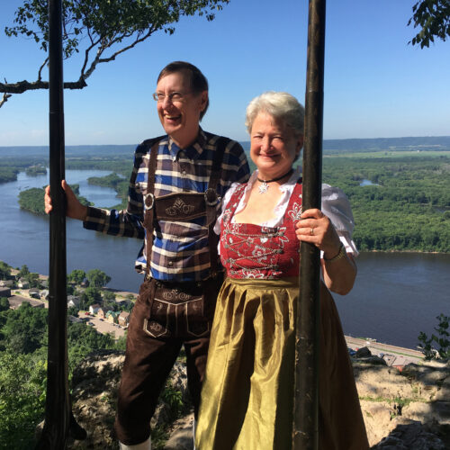
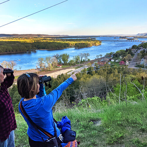
Located 500 feet above Alma, it’s a small park with a big view of the Mississippi River for several miles to the north and south. According to Better Homes & Gardens magazine, “Buena Vista Park is one of the river valley’s finest natural balconies.” Visitors can watch barges traveling the river and locking through Lock & Dam #4. The park is a great birding spot with breathtaking sunsets. Buena Vista Park is handicapped accessible and offers picnic tables, grills, a picnic shelter, restrooms and a small children’s playground. The park also offers a large parking lot that accommodates several vehicles and motor coaches. No camping is allowed. For information, directions and regulations contact the Alma City Clerk at (608) 685-3330.

DRIVE County Road E from Main Street in Alma up the bluff and take a left at the Buena Vista Park sign. There are residences and farms along the way; keep going and the road dead-ends at the park.

HIKE the Buena Vista Trail from Second Street up to the park. To find the trail head from Main Street, turn at the Hotel de Ville onto Cedar Street and go up to Second Street. Go left onto Second Street, and look for the trail sign on your right. In 1996, the McClyman Family granted the City of Alma the right to utilize the trail for a public pedestrian hiking trail.


Mossy Hollow Trail

In 1997, Dairyland Power Cooperative transferred approximately 102 acres of land to the City of Alma on the south end of town and extending up 12-Mile Bluff. Walking and hiking trails start from the Alma Cemetery. Mossy Hollow Trails and the surrounding acreage was designed for hiking and walking, as a nature study area of song birds and wildlife, and for tree and plant identification.


Riecks Lake Park

Rieck’s Lake Park & Campground. This beautiful park within city limits of Alma offers two viewing decks, two pavilions, grills, picnic tables, toilets, and a large playground and swing set. Camping and RV hook-ups are available at a first-come-first-serve basis. Rieck’s Lake is a great viewing spot for a variety of birds and waterfowl.